
Hotline: +84 971 443 717
Français


Tailor Made Holidays with our travel experts
We'll do our best to call you within 48h
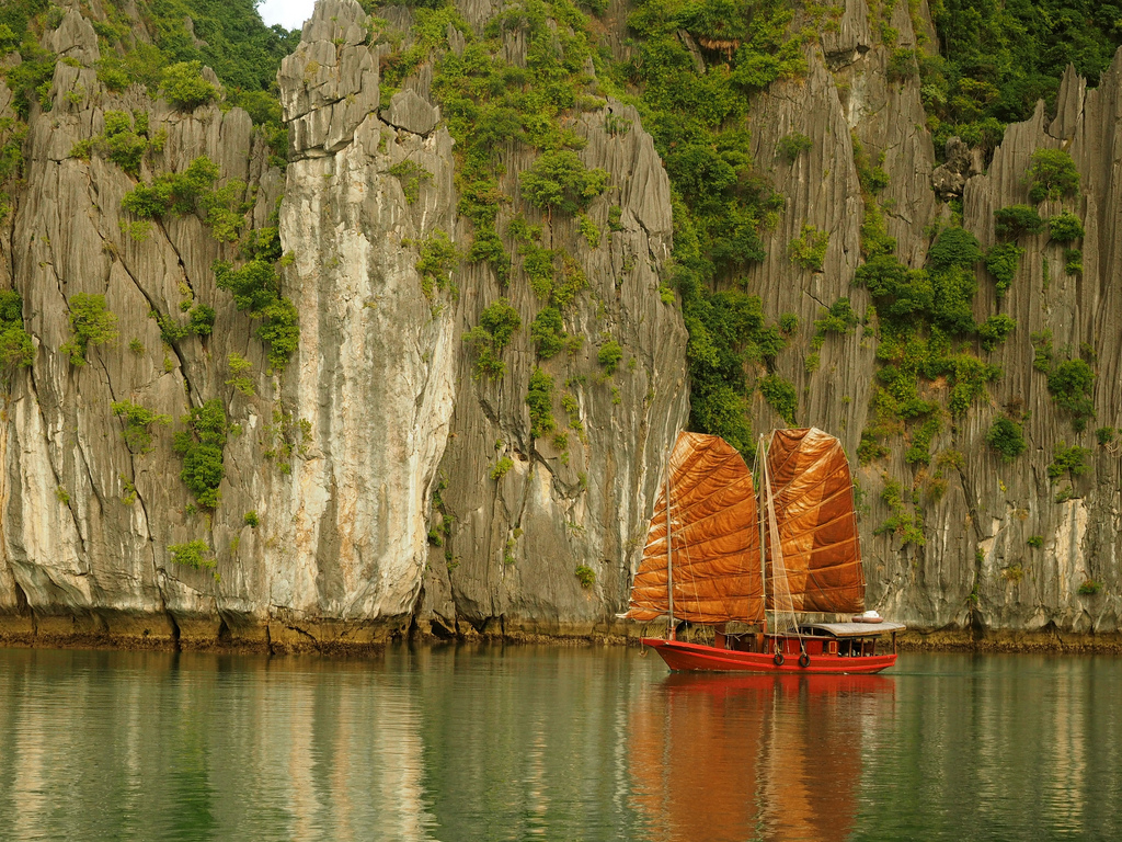

With mountain passes hanging onto cliff-faces high above roaring rivers, and back-roads threading through forests of limestone pinnacles, it’s ideal territory for a motorbike road trip. Food, accommodation and ATMs can now be found throughout the region. This is the perfect time to drive the Extreme North Loop; before traveller numbers rise, but after the completion of necessary infrastructure. Scroll down to read my guide to the loop and view my map of the route.
MOTORBIKE GUIDE for Ha Giang Extreme North Loop
I’ve written this motorbike guide in 3 sections. Note that each section doesn’t necessarily correspond to one day on the road. The total distance of the loop is 320km. If you really want to you can complete the ride in 2 days, but the outstanding scenery on this route is such that I recommend from 3-5 days. Motorbikes are available for rent in Ha Giang City for around $7-10 per day. Officially, foreign travellers still require a permit (300,000vnđ [$14]) to visit this area. However, on my last visit I wasn’t asked to show mine on any occasion. It’s best to check with hotel staff in Ha Giang City on the current requirements before you set out on the loop. If you should require a permit they are available through most hotels in Ha Giang, Dong Van and Meo Vac. The best time of year to ride this loop is September and October, when the weather is warm, colours are bright, and rainfall is light. It can get bitterly cold during winter months. Although all the roads are now in good to reasonable condition, progress is slow due to countless switchbacks and mountain passes. Expect an average speed of 30km an hour. In my guide below I’ve included directions, recommendations of places to stay and eat, and several sights and excursions along the way. From Meo Vac you can forgo the loop by continuing southeast to Bao Lac in Cao Bang Province (see section 3 for details).
SECTION 01: Ha Giang – Quan Ba (Tam Son) – Yen Minh: 100km
Ha Giang, the provincial capital, is a likable city on the banks of the Lo (Blue) River which, despite its name, usually runs muddy and brown. It’s a comfortable place to prepare for the loop and, after the ride, to relax and rejuvenate. There are lots of accommodation options on both sides of the river: Nguyen Trai Street on the west bank and Nguyen Thai Hoc Street on the east bank, which are connected by two bridges, one at either end. I prefer staying on the east bank because it’s close to cheap food options and there are a few good guest houses (nhà nghỉ) right on the riverfront (click HERE for more about nhà nghỉ). Nha Nghi Thuy Tien (19 Nguyen Thai Hoc; Tel: 0913 271 248) has good but aging rooms with balconies overlooking the river for 200-400,000vnđ ($10-20) a night.
On Nguyen Thai Hoc Street there are several rice eateries (quán cơm) where you point and order. These offer decent food for around 40,000vnđ ($2) per person (click HERE for more about quán cơm). If you’re looking for a feast – especially when returning from the loop after a few days of ‘mountain food’ – try the big restaurants on Nguyen Trai Street; on the right hand side just north of the second (northern) bridge. Here you’ll find local specialities, such as salmon hotpot (lẩu cá hồi), for which the region is famous.
Take Road QL4C north out of Ha Giang. It’s only a few kilometres before forested limestone mountains tower over you and irresistibly-blue rivers run alongside the road. After 30km of winding through beautiful valleys, a cheap-looking gate announces your arrival at the Dong Van Karst Plateau Geo-Park. In case you didn’t get it the first time, there’s a sign on the hillside in giant Hollywood-style lettering with the park’s name in Vietnamese and English. The area was designated a UNESCO Global Geo-Park – only the second in Southeast Asia – in 2011. There are information boards by the roadside throughout the geo-park with – often infuriatingly esoteric – details about the land formations in this region.
The road begins a long, snaking ascent up Heaven’s Gate Pass (one of several so-named mountain passes in Vietnam). The views back down over the meandering road are terrific. After crossing a treeless plateau, Heaven’s Gate Pass drops down into Quan Ba District and the town of Tam Son, nestled in a valley between dozens of limestone ‘molehills’. Near the top of the pass there’s an information centre with a coffee shop, where various maps of the area are available. Climb the steps behind the cafe up to a small gazebo for unobscured views of the entire district.
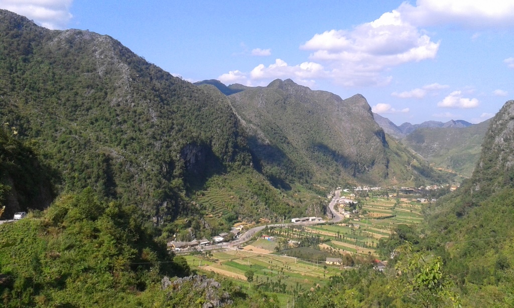
The town of Tam Son has a few nhà nghỉ (guest houses) on the main street, should you feel like stopping for the night. However, most people choose to take lunch at one of the many rice eateries, before continuing on Road QL4C east down to the Mien River valley. Before reaching the valley the road passes a pair of distinctively round hillocks, which someone imaginatively named ‘fairy bosom’. At the end of a series of severe switchbacks the road crosses the Mien River, following its course north through a steep canyon. There’s something beguiling about this bamboo-lined river valley. Hamlets of wooden houses line its banks and naked children fish, play and jump from boulders into the sluggish waters. Before the road veers east it passes the ruined fortifications of Cán Tỷ, which I’m told are from French colonial times, although they look much older.
Another long pass climbs up through a pretty, cultivated landscape close to the Chinese border, before cresting at a cool pine forest. Descending the other side into Yen Minh District, you’ll see the limestone forests of Dong Van Plateau in the distance, looking like the crenulated ramparts of a giant castle. The main street in Yen Minh town has a few hotels to choose from. Try Thao Nguyen Hotel (Tel: 0915 486 624) with clean rooms for 300-500,000vnđ ($15-25). Food is also available on the high-street.
SECTION 02: Yen Minh – Dong Van – Meo Vac: 70km
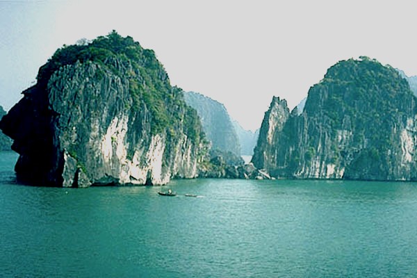
The 70km drive from Yen Minh to Meo Vac (via Dong Van) is perhaps the most remarkable stretch of road in the country. Road QL4C ploughs through a striking landscape of dramatic peaks and troughs, formed over millions of years by tectonic activity and the erosion of the limestone that defines this area. Limestone pinnacles rise and fall at regular intervals, creating the sense that one is in a stone forest. The shapes are so live and animated it’s as if the landscape were in fluid motion until it was suddenly petrified, like a frozen sea. The impression is of a mythical landscape equal to any Tolkienian novel or Chinese ink and wash painting.
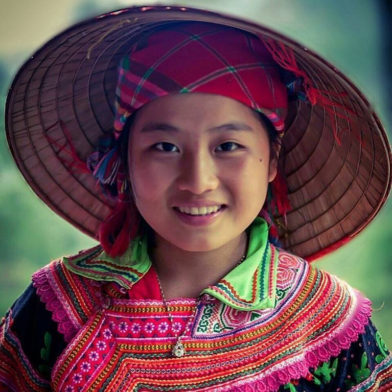
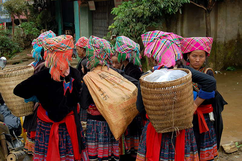
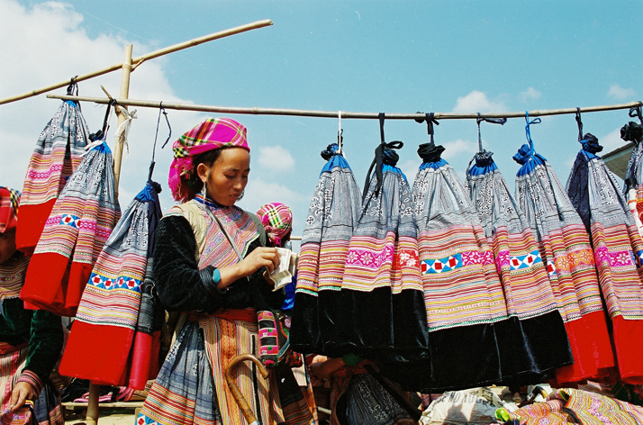
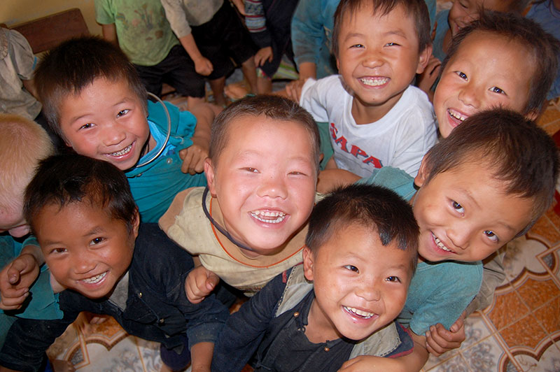
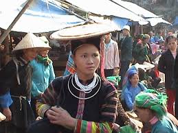
Just as impressive as the topography are the ambitious roads that ride over and around this complex terrain. In the last few years dozens of small paved lanes have been completed, criss-crossing the entire area. These offer tempting diversions, leading to isolated villages hidden deep in this strange landscape. The people who inhabit this region are predominantly ethnic minorities, particularly H’mong. For them, this rocky, treeless land offers little protection from the elements, and crops are limited because of the lack of fertile soil. Travellers who’ve come from Sapa may find minority people in this region less forthcoming when compared to the business savvy minorities in the northwest. However, children all along this route will skip and jump down the road screaming “‘ello” and occasionally putting their hands out for money. It’s a good idea to keep some candy or other snacks on you to offer these children as an alternative to money.
A couple of kilometres after leaving Yen Minh Road QL4C forks. Take the road heading northeast, signposted for Dong Van. A steep pass takes you immediately into the limestone karsts. Trees are noticeably absent from the rocky slopes, and there are no more terraced rice fields and fertile valleys. Instead, you’ll see acres of soy bean plantations, punctured occasionally by clumps of sweet corn and stands of bamboo. Because there are no trees, the majority of structures are made of mud bricks or blocks cut from the limestone. Walled hamlets shelter in the tight clasp of conical hills, their shadows offering the only protection from sun and rain.
After about 30km there’s another fork in the road. For an interesting detour, bear left (due north) and continue on Road QL4C to Lũng Cú, Vietnam’s North Pole. A scenic 45km loop (ending back in Dong Van) this is a popular new pilgrimage for young Vietnamese groups, who make the trip on motorbikes from Hanoi, wearing T-shirts with the Vietnamese flag and ‘I love Vietnam’ printed on them. The ‘pole’ itself (entrance fee; 22,000vnđ [$1]) is a tower atop a small hill with excellent views from the top.
Alternatively, take the right fork (due south then east) to continue on the direct road to Dong Van. In a dramatic valley, just after the fork, there’s a small settlement clustered around a large stone building. This is the former palace of the H’mong king. Well worth a visit, this attractive stone and timber structure was built by the colonial French to keep the H’mong king happy (although I’ve been told several different stories about the construction of this palace). The H’mong king had a fearsome reputation and considerable wealth, gained from growing opium poppies in the area. The palace’s three stone courtyards and tiled rooftops look like a set from the Ang Lee martial arts movie, Crouching Tiger Hidden Dragon. The palace is signposted to the right, down a steep road leading into the valley.
The last 15km to Dong Van is an extraordinary ride through limestone pylons, each one casting a sinister shadow over the deep valley. The road is chiseled out of the mountains, gripping to the side of rocky cliffs. Sometimes there are no barriers; it feels like flying. But drive carefully, especially in the rain, because it’d only take a slight skid on a corner for you and your bike to plunge hundreds of feet into the valley. All along this road there are women and girls – from as young as 10 to as old as 80 – carrying heavy loads of wood, hay, and crops over their backs. The bodies of the older women have been permanently distorted, so that their backs are almost at right angles to their legs, even when walking unburdened.
Dong Van is a fairly dusty town that’s enjoying a mini boom thanks to growing interest in travel to this region. There are now plenty of good places to stay and eat here, and the town boasts two markets; a big market held on weekends (known as the ‘new market’) and a smaller night market held every evening (known as the ‘old quarter market’). The Lam Tung Hotel (Tel: 0965 062 062) has excellent rooms for 300-500,000vnđ ($15-25) and is perfectly located between the ‘new market’ and the ‘old market’. Other guest houses (nhà nghỉ) can be found on the main street. The phố cổ (old quarter) was originally a handful of picturesque old stone houses with tiled roofs. But local authorities have obviously recognized its tourist potential, because now a row of brand new ‘old quarter’ buildings are being constructed here. It’s still quite tasteful and the night market held in the square here is a good place for some inexpensive food and drink.
Saving the best until last, the final stretch from Dong Van to Meo Vac is a 22km ride along the Ma Pi Leng Pass, a staggering road clinging to the edge of a wall of limestone mountains, towering hundreds of feet above the craterous Nho Que River valley. If any mountain pass in Vietnam deserves the title ‘epic’ it’s this one. After a short climb southeast out of Dong Van on Road QL4C, the ground seems to fall away, and you’re left gasping at the enormous chasm below. For 15km the road carves a terrifying path out of the mountainside. Incredibly, farming continues on the near-vertical slopes below and above the pass. This deep, treeless valley has the acoustics of an amphitheater; you can here the voices of children and bleats of goats from way down on the banks of the river, echoing around the mountains. There’s a viewing platform about halfway to Meo Vac where you can find refreshments. In good weather this short stretch of road can take a couple of hours because the views are so superb.
Dropping down to Meo Vac, another dusty town surrounded by peaks, you’ll find a few nhà nghỉ (guest houses) around the bleak, Soviet-looking central market. Although it’s a 5 minute walk (or 30 second drive) from the ‘action’, I like Nha Nghi Linh Anh (63A To 2; tel: 0948 174 669) for its large spotless rooms and very reasonable prices (200-400,000vnđ [$10-20] a night). I find food in Meo Vac less than adequate, but there are street-side barbecues opposite the market and several OK rice eateries, including Com Binh Dan Long Hong on the west side of the market. For breakfast there are cheap fried egg baguettes in front of the market.
SECTION 03: Meo Vac – Ha Giang 150km [MAP] OR Meo Vac – Bao Lac (Cao Bang): 75km
From Meo Vac there are several ways to complete the loop back to Ha Giang. Or, you can forgo the loop altogether, by continuing southeast to Cao Bang Province. Either way, it’s another spectacular ride through karst scenery. The simplest route back to Ha Giang is to leave Meo Vac on Road TL182 heading west. This ‘lower road’ passes through a stark, rock-strewn limestone valley, and loops back around to Yen Minh, from where you retrace your outward route on Road QL4C back to Ha Giang. At 150km this is the shortest option back to Ha Giang.
Other alternative routes offer much wider loops back to Ha Giang. These should be apparent to you when looking at the map. For those with lots of time, you could spend days exploring the small paved lanes within the ‘loop’ created by Road QL4C to the north and Road TL182 to the south. A good place to start is the alternative route between Dong Van and Meo Vac, which I’ve marked on my map with a red line. This road sees hardly any traffic or foreign travellers. Passing through a dry, tree-starved landscape dominated by conical peaks and dotted with tiny settlements, the route offers an insight into how farming works in such a harsh region, and how difficult it must be to sustain a living on this land.
If you don’t want or need to head back to Ha Giang, Road QL4B heads south from Meo Vac all the way down to the Gam River valley. It’s significantly warmer and lusher in this valley. After crossing the Gam turn left (due east) on Road QL34. This is a gorgeous route along a rich, fertile valley to the town of Bao Lac, where several rivers converge. There are a couple of good places to stay on the riverfront here. Try the Song Gam Hotel (Tel: 0978 430 555; 200-300,000vnđ [$10-15] a night) just before entering the town. Bao Lac has some street food vendors around the market and a few rice eateries (quán cơm). From here it’s a straight shot on Road QL34 all the way to Cao Bang City, or south from Nguyen Binh on Road TL212 to Ba Be National Park.